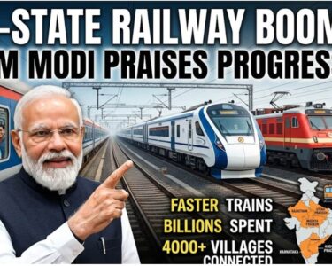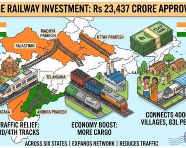

The Indian government has just made a major decision to build new railway tracks across the country. A special government group called the Cabinet Committee on Economic Affairs has approved three massive railway projects. The total cost of these projects is a huge sum of twenty-three thousand four hundred and thirty-seven crore rupees. The main goal of this big investment is to expand the railway lines and make travel much faster and easier for millions of people across six different states.
The three new projects will focus on adding third and fourth tracks to very busy railway routes. These projects are the Nagda to Mathura route, the Guntakal to Wadi route, and the Burhwal to Sitapur route. Together, these upgrades will add about nine hundred and one kilometers of new tracks to the Indian Railways network. The construction will take place across nineteen different districts in Madhya Pradesh, Rajasthan, Uttar Pradesh, Karnataka, Andhra Pradesh, and Telangana. The government hopes to finish all the construction work by the year two thousand and thirty-one.
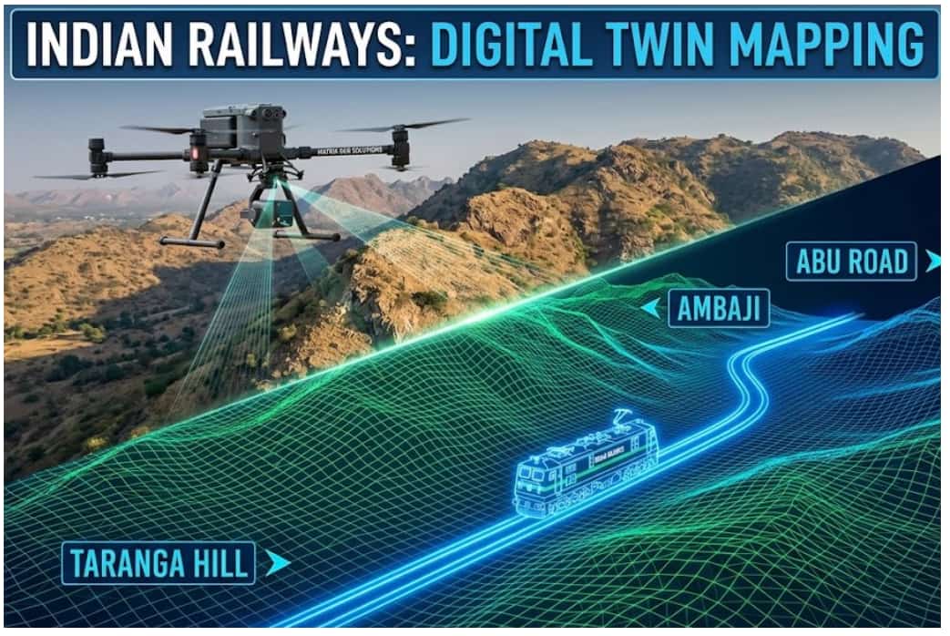
To build this amazing 3D virtual model, Matrix Geo Solutions will fly high-tech drones over the entire area where the new train tracks will go. These drones are not like regular toys. They are equipped with special sensors called LiDAR. This technology uses light from a laser to measure the exact distance to the ground.
By flying these drones, the company can map the ground with incredible accuracy, down to a few centimeters. The drones will take detailed pictures and gather data about everything on the land. This includes trees, rivers, houses, roads, and power lines. All of this information is then put into a computer to create a perfect digital replica of the existing environment.
Once the digital copy of the land is ready, the engineers can place their proposed railway track design on top of it. This 3D model of the new railway will show exactly where the train tracks, bridges, tunnels, and station buildings will be built.
By having this digital model, the planners can test the designs before the actual construction begins. They can look for potential problems, such as a track hitting a building or running too close to a river. Finding these mistakes on a computer screen is much cheaper and faster than discovering them after workers have already poured real concrete.
This technology also allows the teams to create virtual flying videos of the proposed train route. It is like playing a video game where you fly over the new railway track before it even exists. These videos will help different government officers and engineers review the project together. It will make communication much easier and help teams coordinate their work without any confusion.
Using digital twins and drones represents a big shift for Indian Railways. In the past, workers had to walk miles on foot with measuring tools to draw 2D paper maps. This old method took a very long time and sometimes led to mistakes. Now, with drones and computers, planning is incredibly fast and highly accurate.
In the long run, this high-tech digital twin will not just help with building the tracks. Even after the trains start running, the digital model can be used by the railway staff to monitor and maintain the tracks. If a bridge needs repairs years from now, engineers can check the 3D model to find the best way to fix it. This modern project shows that India is using the best technology to make its train travel safer, faster, and much more efficient for everyone.
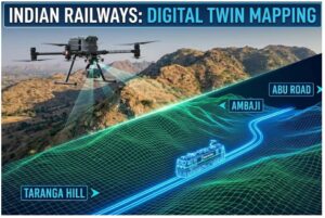
Indian Railways will use advanced Digital Twin technology and LiDAR-equipped drones to plan the new Taranga Hill–Ambaji–Abu Road railway line. The project will create a highly accurate 3D virtual model of the route, helping engineers detect design issues before construction begins. The modern system is expected to improve planning accuracy, reduce costs, and support long-term railway maintenance and safety.